Wednesday, 25 February 2015

LOVE AMONG THE BOOKSHELVES: NOTTING HILL


Released in 1999 and one of a series of films by the writer Richard Curtis, the romantic comedy Notting Hill, starring Hugh Grant and Julia Roberts, was both set in and filmed around the London district of the same name.  The uber-cool shops, restaurants and cafes of this sought-after part of London provided the perfect backdrop for this tale of a romance between book shop owner Will Thacker (Grant) and a very famous American film actress called Anna Scott (Roberts).  The unlikely pair gradually fall for each other in spite of Will's modest way of life, which includes sharing a flat with the revolting Spike (hilariously portrayed by Rhys Ifans). 

One of the most famous attractions in Notting Hill is the Portobello Road Market.  Number 142 Portobello Road was used in the film to portray Will's shop, while in real life it was the site of an antiques arcade, although it has since changed hands.  Will gets off to a bad start with Anna when he upsets orange juice over her white t-shirt: the coffee shop where he buys the orange juice is at 303 Westbourne Park Road, which is now a barber's.  The entrance to Will's flat features in one of the film's funniest moments when the papparazzi  turn up in search of Anna Scott, only to be confronted with a half-naked Spike flexing his dubious muscles.  The actual location of the blue doorway as seen in the film is at 280 Westbourne Park Road, which was once the home of Richard Curtis.  The blue door used in the film was removed and auctioned off as people kept turning up and leaving graffiti on it.  The scenes showing Will relaxing on his roof terrace were filmed at 113 Portobello Road, which is currently an art shop which forms part of the the Antique Arcade.  

File:Portobello4.jpg

Portobello4. Photo by Albeins, via Wikimedia Commons.


Will has a restaurateur friend called Tony, whose establishment is represented by a location at 105 Golborne Road; this is now a card, poster and gift shop.  In one scene, Will is shown going to see one of Anna's films in a lovely old cinema, the cinema in question being the Coronet Cinema, a fabulous confection of neoclassical features and one of Notting Hill's most iconic buildings.  In another scene, after a dinner at the house of Will's friends Bella and Max, which was filmed on location at 91 Lansdowne Road, Will and Anna break into a private communal garden.  The gardens used for the scene were Rosemead Gardens, part of a residential area called the Ladbroke Estate right in the heart of Notting Hill.  Such expensive living spaces are typical of the area, and were hilariously sent up in Rachel Johnson's novel Notting Hell.    

File:Coronet Cinema, Notting Hill Gate 02.JPG

Coronet Cinema, Notting Hill Gate 02. Photo by Edwardx, via Wikimedia Commons.


For those unfamiliar with the area, Notting Hill lies to the north of Kensington and northwest of Hyde Park.  The big event of the year is the Notting Hill Carnival, the nearest thing Britain has to a real Latin-style carnival, which takes place at the end of August each year.  Notting Hill has not always been as universally upmarket as it is today.  The area around Pottery Lane was such a miserable slum in the 19th century that it was commonly known as the "Potteries and the Piggeries" - at one time there were thought to be roughly three pigs to every person.  But then there was the other side of the coin, with exclusive enclaves such as the aforementioned Ladbroke Estate, which belonged to the wealthy Ladbroke family in the 19th century and was developed according to a plan drawn up by the architect Thomas Allason, who envisaged a large central circus with streets radiating out from it and garden squares.  Today, the estate is a conservation area looked after by the Ladbroke Association.  

File:Stanley Crescent garden and houses - geograph.org.uk - 837128.jpg

Stanley Crescent garden and houses - geograph.org.uk - 837128. Photo by David Hawgood, via Wikimedia Commons.


Notting Hill is by no means the only film featuring this vibrant, cosmopolitan part of London.  A range of other films have made use of locations in the area, from Alfie and Blow-Up in the 1960s, the crime drama 10 Rillington Place and Antonioni's The Passenger in the 1970s, Withnail and I in the 1980s, right up to London Boulevard starring Keira Knightley in 2010, to name but a few.

The Visit London website is a good source of practical information for visitors to the area.

Map of the area.


Tuesday, 3 February 2015

PINING FOR THE CAM: RUPERT BROOKE AND GRANTCHESTER


When in the beautiful university city of Cambridge, if you want to escape the hubbub of the centre you should make your way along the banks of the Cam to the village of Grantchester, a riverside settlement with charming pubs and cottages.  Probably the best known building in the village is The Orchard Tea Garden, which is known in literary and academic circles as the place where a group of talented friends known as the Grantchester Group used to congregate.  The group included philosophers Bertrand Russell and Ludwig Wittgenstein, writers E. M. Forster and Viriginia Woolf, the economist Maynard Keynes, the artist Augustus John and the poet Rupert Brooke.

Brooke, who moved into Orchard House in 1909, was a central figure to the group.  His boyish good looks and floppy hair once moved the Irish poet W. B. Yeats to describe him as the "handsomest young man in England".  This was a peaceful period when hedonism was the order of the day, and the group led an idyllic existence, skinny dipping in the river and hanging out together in the orchard.  On one occasion Brooke and Virginia Woolf swam naked by moonlight in a weir pool known as Byron's Pool, a reminder of  an earlier poetic presence in the village.  However, as was the case for so many people, the fun ended abruptly in 1914 with the onset of World War I.  Brooke entered the war by joining the Navy, and he sailed with the British Mediterranean Expeditionary Force in 1915.  Tragically, he died of sepsis brought on by an infected mosquito bite while moored off the Greek island of Skyros.  He was buried there, and the grave remains on the island to this day.  

File:River Cam at Grantchester - geograph.org.uk - 808244.jpg
River Cam at Grantchester - geograph.org.uk - 808244. Photo by Trevor Peach, via Wikimedia Commons
 
In May 1912 Brooke found himself in Berlin, and was so overcome with nostalgia for Grantchester that he penned a poem called 'The Old Vicarage, Grantchester'.  In the poem he recalls wistfully the flowers in the garden: "And in my flower-beds I think//Smile the carnation and the pink".  Suffering from the Berlin heat, he longs for the cool river back home: "The stream mysterious glides beneath//Green as a dream and deep as death", and "And there the shadowed waters fresh//Lean up to embrace the naked flesh".  He then pokes fun at the Germans and their rules and regulations: "Meads towards Haslingfield and Coton//Where das Betreten's not verboten."  (an allusion to the German mania of the time for banning people from walking on grass).  He also has a go at the inhabitants of the other neighbourhoods in and around Cambridge, accusing them of being miserable, as in the lines "Strong men have run for miles and miles//When one from Cherry Hinton smiles", in contrast to Grantchester, where "They love the Good, they worship Truth//They laugh uproariously in youth".  

File:Grantchester Mill Pond - geograph.org.uk - 649084.jpg
Grantchester Mill Pond - geograph.org.uk - 649084. Photo by Sebastian Ballard, via Wikimedia Commons


The Orchard Tea Garden still serves tea to thirsty passers-by today, and the wooden tea pavilion still stands there.  For those who want something stronger, the pleasant selection of pubs in the village includes one named after Rupert Brooke.  The walk to Grantchester is an easy 2-mile hike along well-worn riverside paths taking in the verdant stretch known as Grantchester Meadows.       

File:The Red Lion - geograph.org.uk - 649097.jpg
The Red Lion - geograph.org.uk - 649097. Photo by Sebastian Ballard, via Wikimedia Commons
Map of the area.

Saturday, 17 January 2015

CASTLES AND COAST: GAME OF THRONES PART 2, COUNTY ANTRIM

Sadly, until a few years ago for me any mention of Northern Ireland conjured up images of violence and conflict, in other words the so-called 'Troubles' which lasted for several decades, ending with the 1998 'Good Friday Agreement'. So when we went to the Republic of Ireland for a holiday and decided to stray over the border, principally to see the Giant's Causeway, I was unsure what to expect. However, I am happy to report that I was blown away by the scenery we encountered, especially on the Antrim coast. Clearly the makers of Game of Thrones also hold this part of Northern Ireland in high regard, as there are many Antrim locations which feature in the series.

The drama of the Antrim Coast lends itself well to a series such as Game of Thrones. The Iron Islands seen in Series 2 are located in the area around Ballintoy Harbour, and the harbour itself is used as a landing place for the islands, scene of Theon's homecoming. Ballintoy is just a short distance from the Carrick-A-Rede Rope Bridge, a scary but fun bridge used for accessing a small island just off the mainland. Close to the Rope Bridge is the headland of Larrybane, the dramatic setting for Renly Baratheon's camp. The small, picturesque village of Cushendun lies further round the coast to the east, and is famous for its caves, which are believed to have been formed over 400 million years ago. In the series the caves are the location of Storm's End, where Davos Seaworth and Lady Melisandre make their landing and where the 'shadow baby' is born. The unspoilt Murlough Bay near Ballycastle is the scene of Theon's horse ride with his sister yara, and is also where Davos is rescued from the Fingers by a passing ship. Downhill Beach on the Causeway Coast, with the tiny Mussenden temple perched high on a cliff top, became Dragonstone for series 2, where Stannis pulls the flaming sword and Melisandre proclaims "For the night is dark and full of terrors".

File:Ballintoy harbour - geograph.org.uk - 820159.jpg
Ballintoy harbour - geograph.org.uk - 820159. Photo by Ross, via Wikimedia Commons.


As well as its coastline, County Antrim is known for its history and heritage, particularly its castles. Probably the most spectacularly situated of these is the ruined Dunluce Castle, on a clifftop with sheer drops on either side. This dramatic location attracted the attention of early Christians and Vikings. In the series, Dunluce Castle doubles as the House of Greyjoy. Shane's Castle, meanwhile, is a ruined 14th-century castle on the shore of Lough Neagh near Randalstown. The tournament scene from season 1 was filmed with the castle as a suitably evocative backdrop.

File:Brinkview Dunluce Castle.jpg
Brinkview Dunluce Castle. Photo by Osioni, via Wikimedia Commons.


Several distinctive features of the County Antrim landscape are seen in the series. In the uplands between Ballymena and Larne is the majestic Slemish Mountain, generally regarded as the first known Irish home of St Patrick. On St Patrick's Day large crowds ascend the mountain on a pilgrimage. The mountain towers over the Shillanavogy Valley, which in Game of Thrones is used to depict the Dothraki grasslands. Another prominent natural feature in the area is an avenue of arched beech trees known as 'The Dark Hedges' near Armoy in the north-east of the county. In Game of Thrones, this is the King's Road where Arya disguises herself as a boy to evade capture en route to Winterfell. Finally, the Magheramorne Quarry, five miles from Larne, is where Castle Black, home to the Night's Watch, is found. It is also the location of The Wall, which protects the northern border of Westeros. The quarry was given a snowy makeover for the series.

File:Dark Hedges, County Antrim, Northern Ireland (6961336542) (2).jpg
Dark Hedges, County Antrim, Northern Ireland (6961336542). Photo by John5199, via Wikimedia Commons.

Further information about Northern Ireland locations featured in TV and film can be found on the Discover Northern Ireland website. The locations featured are easily reached from Belfast, which has an International Airport.


Sunday, 4 January 2015

FROM BURMA TO NORTH BERWICK: THE RAILWAY MAN


One of the most brutal episodes in the Far East during the Second World War was the forced labour visited by the Japanese on the allied prisoners of war who were taken to Kanchanaburi to participate in the building of the Burma Railway.  The railway is often referred to as the Death Railway due to the unimaginable numbers of fatalities which occurred during its construction: around 90,000 Asian labourers and 12,399 allied POWs perished.  One of those who survived was Eric Lomax, a British Army officer born in Edinburgh.  Although he did survive, he did not come out of it unscathed, as the 'demons' and the nightmares arising from his experience stayed with him well beyond his return to Britain.  Lomax is the 'Railway Man', the main character in a recent film based on Lomax's autobiography of the same name, with Colin Firth in the main role.

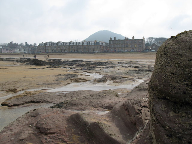
One of the film's main themes is the romance which develops between Lomax and a young woman called Patti (Nicole Kidman) after they meet, appropriately, on a train. It is Patti who helps Lomax confront his wartime demons.  The scene in which the couple are married was shot at St Monans Parish Church, a simple but striking place of worship in the Kingdom of Fife, which dates back to the 9th century.  The church occupies a lovely spot right next to the sea in St Monans, a former fishing village which is now popular with yachting enthusiasts.  Once married, they are seen making their life together at their home in a bracing beachfront location.  The filmakers chose Tantallon Terrace in North Berwick for the Lomax home.  The terrace is named after one of the big draws in the area, Tantallon Castle, which lies a few miles along the coast on a clifftop opposite the spectacular Bass Rock, a magnet for seabirds which is accessible via the boat trips offered by the Scottish Seabird Centre in North Berwick.  North Berwick is a harbour town whose most venerable building is the 12th century Auld Kirk, which in the 16th century was the scene of the North Berwick Witch Trials.  

File:Marine Parade, North Berwick - geograph.org.uk - 376591.jpg
Marine Parade, North Berwick - geograph.org.uk - 376591. Photo by Lisa Jarvis, via Wikimedia Commons.


 Aside from the above locations, Perth Railway Station plays a starring role, standing in for Crewe station, at which Lomax boards the train where he meets Patti, and again for Edinburgh Waverley Station.  Calton Hill in Edinburgh also gets a look in, with its unfinished 'acropolis' monument.  The hill is renowned for its magnificent views over the city. The Bo'ness and Kinneil Railway played a pivotal role in the meeting of Lomax and Patti; this heritage railway covers five miles of track between Bo'ness and Manuel Junction near the village of Whitecross, Falkirk.  Another iconic sight, which features in the film's trailer, is the Glenfinnan Viaduct.  This impressive structure, which is used by the Jacobite steam train, may be familiar to film buffs, as it was also used in the Harry Potter films (see my post 'Pottering Around on the Jacobite Steam Train', from 23 December 2013). 

File:Bo'ness Railway Station - geograph.org.uk - 1072827.jpg
Bo'ness Railway Station - geograph.org.uk - 1072827. Photo by Henry Clark, via Wikimedia Commons.


Tuesday, 16 December 2014

GHOSTS OF CHRISTMAS PAST IN LONDON: A CHRISTMAS CAROL


During his long and prolific writing career, Charles Dickens wrote many Christmas stories, but the best known one must surely be A Christmas Carol, first published in 1843.  The main character of the story is Ebenezer Scrooge, a man whose penny-pinching and mean spiritedness was such that his surname  has become synonymous with mendacity in the English language.  You will often hear people say things like "Oh, he's a right old Scrooge".  During the course of a series of chapters, or staves, Scrooge is visited by a series of ghostly apparitions who take him to see a variety of Christmas scenes designed to make him change his ways, the most heartbreaking of which is when the Ghost of Christmas Yet to Come shows him a time in the future when Tiny Tim, the son of Scrooge's long-suffering and poorly paid clerk Bob Cratchit, has died because Cratchit's pay is insufficient to look after his sickly son properly.  By the end of all this, Scrooge undergoes a transformation, his new-found largesse leading him to donate a Christmas turkey to the Cratchit family.

The opening paragraph includes a reference to 'Change.  This was how the Victorians referred to the Royal Exchange, a London centre of commerce founded in the 16th century by the merchant Thomas Gresham.  The building was devastated by the Great Fire of London, and suffered another fire in 1838, but has been returned to its former glory.  Commerce is still alive and kicking today at the building, which is next to the Bank of England: it is now a luxury shopping centre with designer stores and smart restaurants.  The building's grand facade, with the appearance of an ancient Greek temple, is as pretty as a picture at this time of year, with its columns all lit up and a huge Christmas tree in front.

File:The Royal Exchange - geograph.org.uk - 863444.jpg
The Royal Exchange - geograph.org.uk - 863444. Photo by Peter McDermott, via Wikimedia Commons

As for Scrooge's hangouts, his counting house lay in an alley in the heart of the City, off Cornhill, which runs east from the Bank underground station.  Dickens describes the building as facing an ancient church tower, "whose gruffold bell was always peeping down at Scrooge out of a Gothic window in the wall".  His house was at 45 Lime Street, off Leadenhall Street, "a gloomy suite of rooms", where the yard was so dark that even Scrooge, who lived there, "was fain to grope with his hands".  The well-known Leadenhall Market (known as much as anything for its role in the Harry Potter films) lies nearby, and may well have been where Scrooge went to get the turkey for the Cratchits.  Today, Lime Street is home to the futuristic Lloyds Insurance building, on the site of the former East India House. 

The wretched Bob Cratchit and his family lived in Camden Town, which in those days was a filthy slum.  The area around Agar Grove in the east part of Camden is described by Dickens as "a complete bog of mud and filth".  Hard to believe today, since Camden Town is now an achingly hip and trendy part of London, most famous for its amazing market which is guaranteed to be heaving on weekends.  Another place referred to in the novel is Mansion House in Walbrook, the Lord Mayor's official residence.  This neoclassical house was built by George Dance in 1753 and it has its own court and prison cells.  Dickens recounts how the fifty cooks and butlers were ordered to "keep Christmas as a Lord Mayor's household should".  

File:Starbucks at Camden Market.jpg
Starbucks at Camden Market. Photo by CherryX, via Wikimedia Commons

Charles Dickens fans visiting London who want to explore the areas featured in the novel can join an A Christmas Carol walking tour.  The Charles Dickens Museum at 48 Doughty Street in Holborn occupies the house where Dickens lived from 1837 to 1839.

Map of the area around Lime Street.


Saturday, 22 November 2014

HERE BE DRAGONS: GAME OF THRONES PART 1, COUNTY DOWN


Game of Thrones, a kind of medieval fantasy adventure for adults (it has an 18 certificate), is based on the novel A Song of Ice and Fire by George R. R. Martin about the fight for control of the fictional land of Westeros involving several noble families.  The TV adaptation of Martin's work, made by HBO and launched in 2011, is being screened by Sky Atlantic in this country, and is currently on season 4, although at least two more are planned.  The show's visual impact owes much to the wild beauty of Northern Ireland, particularly County Down and the Antrim coast.  This piece will cover the main locations used for the series in County Down; the Antrim coast will have to wait for another time. Watch this space.   

Anyone visiting the low-lying areas of County Down cannot fail to notice the Mountains of Mourne, which dominate the horizon hereabouts.  The mountains form the backdrop to many of the scenes in Game of Thrones, often decked out in snow for added effect.  The bleak, windswept conditions on the mountains must have been an endurance test for the cast and crew, but as one of the team remarked in an interview, this adds to the authenticity of the proceedings.  This, after all, is the northern edge of civilization for the peoples of Game of Thrones.  The scenes depicting the Stark family seat, Winterfell, make use of the estate of Castle Ward on Strangford Loch (Doune Castle in Scotland was used in the pilot series for the external shots).  King Robert is seen arriving at Winterfell with his entourage in season one; this scene was shot at Old Castle Ward, a 16th century ruin in the lower part of the estate.  Near Castle Ward is Audley's Field and Castle, the scene of Robb's camp, where viewers witness the capture and release of the Kingslayer and Talisa tending to the wounded.    

File:A southerly view of Audley's castle, County Down - geograph.org.uk - 1659939.jpg
A southerly view of Audley's Castle, County Down - geograph.org.uk - 1659939. Photo by Des Colhoun, via Wikimedia Commons.

In the foothills of the Mourne Mountains lies Tollymore Forest Park, where Theon is stalked by Ramsay Snow.  This area is used to depict the snow-covered lands between Winterfell and the Wall.  Meanwhile, the monastic ruins of Inch Abbey on the River Quoile outside Downpatrick also feature heavily in the series.  The river itself is used as the Riverlands, home of the Tullys, and the area around the abbey features in Hoster Tully's funeral as well as the journey undertaken by The Hound and Arya towards the Red Fork.

File:Newcastle Co, Down - geograph.org.uk - 97011.jpg
Newcastle Co, Down - geograph.org.uk - 97011. Photo by Patrick Haughian, via Wikimedia Commons.

Tourism providers in Northern Ireland have been quick to cater for visiting Game of Thrones fans.  In particular the National Trust owned Castle Ward, where Clear Sky Adventure offers a range of activities including the chance to dress up in character costumes and indulge in a spot of archery.  There are also boat tours and self-guided cycle trails taking in some of the locations used in the filming of the show such as Winterfell, Robb's Camp and Dreadfort.  

File:Old Castle Ward.JPG
Old Castle Ward. Photo by Irishdeltaforce, via Wikimedia Commons.

The County Down locations are easily accessible from Belfast, which has an International Airport as well as ferry links to Liverpool, the Isle of Man and Cairnryan (Stranraer) in Scotland.

Map of County Down.


Wednesday, 29 October 2014

ZOMBIE APOCALYPSE IN GLASGOW: WORLD WAR Z

It is not unknown for mayhem to erupt on the streets of Glasgow, as anyone who has been there on a Saturday night will testify. But the chaotic scenes that were witnessed in the area around George Square in August 2011, rather than the product of a booze-sodden populace enjoying a night out, came about during the filming of the zombie horror epic World War Z, based on the book by Max Brooks and starring Brad Pitt. In the film the world succumbs to an outbreak of plague which turns people into zombies. Brad Pitt plays a former UN investigator, Gerry Lane, whose role is to save the world from this terrifying scourge. Some of the film's most dramatic scenes were filmed in Glasgow, which was transformed into Philadelphia with the help of American road signs and flags, yellow taxis and kerbside newspaper dispensers. One can't help wondering why the film-makers didn't just go ahead and film the scenes in Philadelphia in the first place. Still, the city makes a good stand-in with its solid big city architecture and its wide streets.

Early on in the film Lane finds himself stuck in traffic with his family in Cochrane Street as the zombie hordes approach (of course it goes without saying that the family manages to escape unscathed). As the people start to panic, setting off a stampede in front of the City Chambers in George Square, an errant rubbish truck ploughs into the traffic and overturns. Soldiers and policemen (in suitably American uniforms) flood into the scene in an attempt to head off the danger. George Square is the civic heart of Scotland's second city, laid out in 1781 and named after King George III. The headquarters of Glasgow City Council occupies the elaborate Glasgow City Chambers building on one side of the square, and there are a number of monuments, including one to Robbie Burns and the only known equestrian statue of Queen Victoria and Prince Albert. Probably the most dramatic episode in the square's real-life history came in 1919 with the Black Friday rally by campaigners for better working conditions, which ended in scenes of violence which were met with tanks and troops.

File:City Chambers, Glasgow, Scotland.jpg
City Chambers, Glasgow, Scotland. Photo by Andy Farrington, via Wikimedia Commons.

The makers of the film made the most of their time in Britain by including a number of other locations around the country. Still in Scotland, Lane is seen driving a camper van past a plastics factory on Wholeflats Road, Grangemouth, near Falkirk. Meanwhile, down south, the Heygate Estate in Southwark features in a scene in which the Lane family hide and await rescue by helicopter. The picture-perfect Lulworth Cove in Dorset puts in an appearance when Lane crosses the bay in a speedboat to meet his family - the cove plays the part of a 'safe zone' in Nova Scotia. A business park in Sandwich, Kent, called Discovery Park is the location of a WHO laboratory (and our brand new Doctor Who Peter Capaldi plays a WHO doctor in the film!). The Royal Fleet Auxiliary ship Argus, which was in the news recently for its role in the fight against ebola, was renamed the USS Madison and Brad Pitt turned up in its home port Falmouth for some of the filming. Some of the sets for the film were built on the disused Bovingdon Airfield in Hertfordshire.


File:Lulworth Cove - geograph.org.uk - 587780.jpg
Lulworth Cove - geograph.org.uk - 587780. Photo by Julian Dowse, via Wikimedia Commons.


The film attracted mixed reviews, some of them less than complementary. But hey, it's Halloween, and Halloween wouldn't be the same without settling down to some enjoyable tosh on the big screen would it?

Map of the George Square area.